Coastal Connecticut hike a stone's throw from Westerly is a magnet for migrating birds
STONINGTON, Conn. – Walking Rhode Island seldom wanders outside the state.
But a few years ago, when I hiked on the Pachaug Trail, which skirted Beach Pond in Exeter, crossed the border into a state forest in Connecticut and then wound by steep cliffs, deep caves and ledges, readers told me they liked following the path into another state.
So, when a hiking buddy invited me to hike at the Barn Island Wildlife Management Area on Connecticut’s coast, just across Little Narragansett Bay from Watch Hill in Westerly, I decided to give it a try.
From a tidal marsh in the preserve, I spotted the Watch Hill Lighthouse and realized that the salt marsh, migratory birds and vegetation I saw at Barn Island are affected by the same issues I’ve seen along Rhode Island’s coastline.

There was also a unique, unexpected finding. When I hiked inland, I passed an old farm site where a slave worked for 26 years to win his and his family’s freedom.
Though it was a short trip, the venture into Connecticut taught me quite a bit.
We set out on a cool but sunny March morning from the trailhead off Palmer Neck Road, which skirts the west side of Barn Island, a 1,013-acre preserve managed by the Connecticut Department of Energy and Environmental Protection (DEEP). At a gate, a flat granite stone is etched with a dedication to Louis Bayer (1906-1996), the late state game warden and artifact collector who worked to preserve the marshes at Barn Island.
After the war, the state purchased the land in several pieces over many years. The funds came from local, state and federal sources, including an excise tax on sporting arms and ammunition through the Federal Aid in Wildlife Restoration Act.
The preserve’s name comes from a barn on the southern tip of the island that the U.S. Navy used for dive bombing and machine gun target practice during World War II.
Trail begins in a sustainable garden of native plants
The trail starts out through a sustainable garden of plants that thrive in a coastal environment and require little maintenance, except weeding. The plants also slow the spread of invasive species, such as Japanese barberry, Oriental bittersweet and Japanese honeysuckle, while providing food for birds, insects, mammals and microorganisms.
From an overlook at the garden’s edge, there’s a sweeping, panoramic view to the south of the ocean, with Watch Hill in the distance. With binoculars, you can see some of the cabanas near the Watch Hill Yacht Club, but Napatree Point is partially blocked by an island. The Pawcatuck River flows into the bay from the east.
Just below the overlook is a sprawling marsh – a mixture of inland freshwater and ocean salt water. The tidal marsh was formed thousands of years ago as rising ocean waters flooded the coastal land and deposited marine sediments that supported the growth of wetland grasses.

I was intrigued by the tidal creeks that run inland from the ocean and are crossed by man-made, straight-as-an-arrow trenches that form a crosshatch in the wetlands. I learned later that the trenches were dug in the 1930s to drain stagnant water from the marsh to eliminate mosquito-breeding habitat.
But the trenches drained too much water and damaged the habitat of migrating ducks, geese and birds. So, a network of low earthen dikes was built to create shallow ponds with interconnecting channels to hold water on the marsh surface. The open water provides a habitat for minnows, which feed on mosquito larvae.
After a long look, we followed a flat, wide path of crushed stone that turned downhill and crossed a low impoundment across the marsh.
Why are salt marshes so important to the shoreline ecosystem?
The dike was lined with tall reeds and some salt-tolerant plants, such as salt-meadow cordgrass. We also passed what’s called salt panne, a shallow depression in the marsh surface where plants that have adapted to high levels of salinity live. They also provide a feeding habitat for shorebirds, wading birds and waterfowl.
Along the impoundment, we studied several round metal culverts installed under the dikes in the 1970s that allow the flushing of tidal water, called a tidal exchange, which helps native plants to thrive. I had learned while walking along Rhode Island’s coast that salt marshes are a critical part of the shoreline’s ecosystem because they support nurseries for fish, feeding grounds for wading birds and nesting areas for migratory birds. They curb erosion, prevent flood damage and improve water quality.
I also remembered a hike at Touisset Marsh in Warren, where rising water from Chase Cove sometimes floods a tidal creek and had degraded the low saltmarsh.
Also, Alex Kuffner, a Providence Journal writer and a former colleague, has written extensively about the impact of climate change and rising seas on the Rhode Island coastline and endangered birds such as the saltmarsh sparrow.
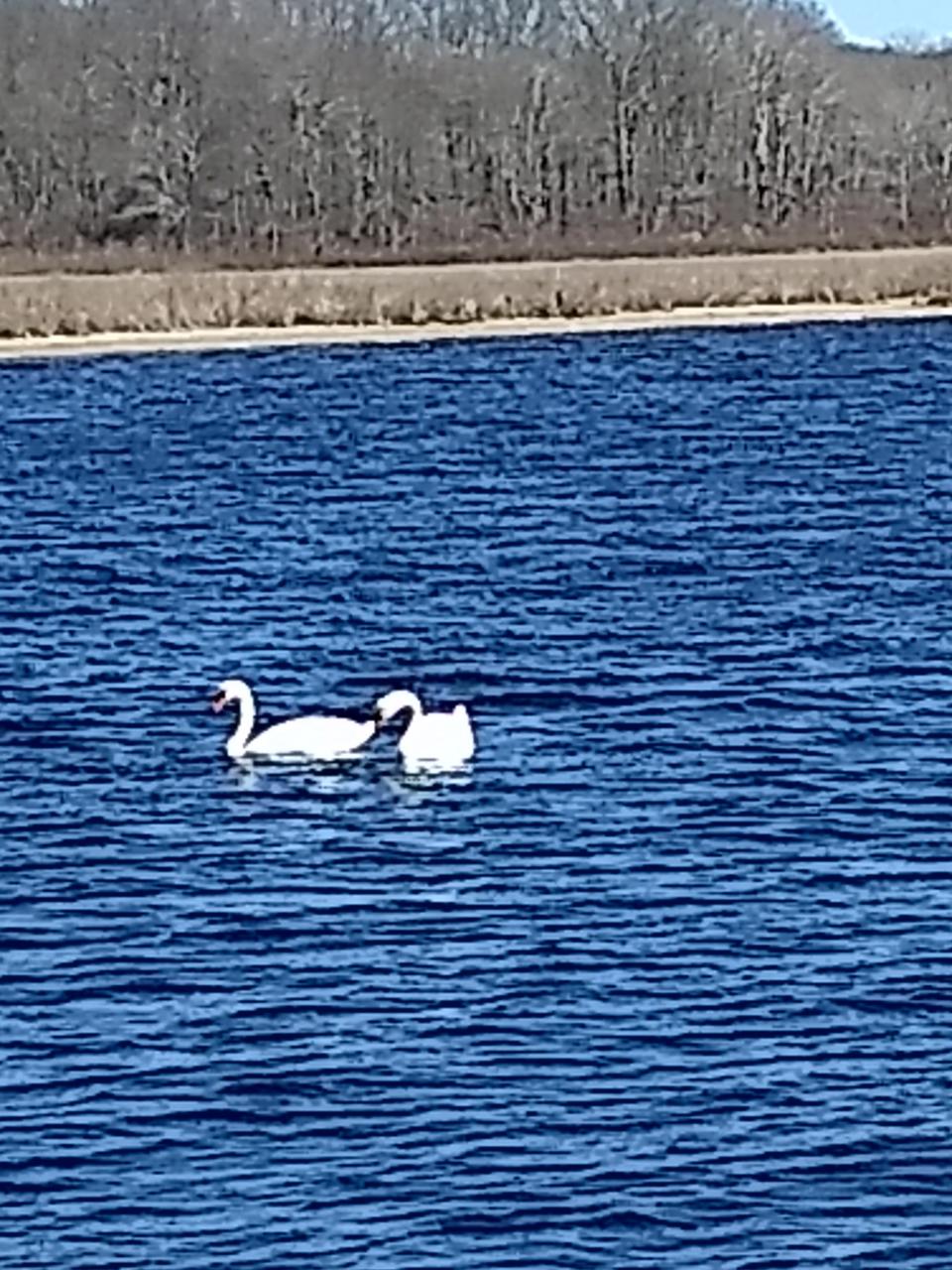
200 species of migratory birds visit the marsh
Farther down the path, we reached a junction and turned right on a wide dike flanked by marsh on both sides. We saw ducks, egrets, herons, mergansers and an empty osprey nest.
We met a pair of birders, who said that in various seasons they had identified many of the 200 migratory birds that fly into the marsh. They also told us a tower off the beach is part of a network from Canada to Florida that collects the signals of 40 migratory birds that are tagged with transponders. The information is used to track the birds and preserve the habitats where they land along the East Coast.
Environment: The quahog holds a dear place in RI’s culture. Could its days be numbered?
The trail continues for about a half mile, passing a cemetery that dates to the 1600s, before ending at the property line. We decided, however, to explore the high ground of the preserve, so we turned, retraced our steps to the junction and turned right on a red-blazed trail that passed through a stand of trees painted with faces. The path led slightly uphill into an upland forest of oak, hickory and maple trees.
Side spurs led to fields that are managed to provide cover and food for Eastern bluebirds, blue-winged warblers, cottontail rabbits and bobwhite quail.

A golf course was once proposed for the wooded area in the northern part of the preserve. But when environmentalists raised concerns that the downhill drainage of fertilizers and other chemicals would damage the coastal marsh, the state purchased 144 acres in 2004 with funds from the federal government and The Nature Conservancy, a nonprofit environmental group.
The story of Venture Smith, a former slave turned landowner, businessman and author
We followed an old farm road through the woods to a marker for the Venture Smith farm site. After the hike, I learned Smith was enslaved in West Africa at age 10 and shipped to New England, where he worked for 26 years before buying his freedom and that of his two sons, his wife, his daughter, and several other Africans.
As a freeman in 1770, Smith bought acreage, including the farm where he had previously worked, on the current Barn Island site.
He later sold the land and died on Sept. 19, 1805, at age 76 as an American citizen, businessman, landowner and author, who some believe is among the first African Americans to write and publish his own autobiography.
In April 2022, the U.S. Congress recognized April 10 as “Venture Smith Freedom Day” and cited a phrase from his book: “My freedom is a privilege which nothing else can equal.”

Continuing on the trail, we passed through old farmland marked with lines of stone walls and small earth-and-stone bridges that crossed streams and rivulets carrying runoff from the hillside.
After about a mile, the trail opened on Palmer Neck Road at a narrow bridge over railroad tracks that carry Amtrak trains. We turned left and followed the road, with houses on the right with waterfront views of Wequetequock Cove. The road led back to where we parked. In all, we hiked 4.2 miles over two hours.
Before we left, we wanted a last look at the bay and walked a short distance down the road to a boat launch. From a short rock jetty, we studied the marsh in the foreground, the ocean and Rhode Island’s coastline in the distance. After hiking on both sides of the border, I realized there were more similarities – including environmental challenges – than differences between the states.
That lesson was worth the walk.
If you go ...
Access: Off Interstate 95 south, take exit 91 and turn left on Connecticut Route 234 east (Pequot Trail). Turn right on Farmholme Road and turn right on Route 1. Take a left on Greenhaven Road and a left on Palmer Neck Road to the trailhead on the right.
Parking: Available in roadside lots.
Dogs: Allowed, but must be leashed.
Difficulty: Easy on wide paths with some hills.
GPS Coordinates: 41.3295, -71.8684
Trail Tip: R.I. Cemetery Weeks
Dozens of free tours, clean-ups, gravestone conservation demonstrations, talks and other programs about historical cemeteries will be held in April and May, organized by the Rhode Island Advisory Commission on Historical Cemeteries and the Rhode Island Historical Preservation & Heritage Commission.
For a calendar of events, visit rihistoriccemeteries.org/events.aspx.
Lectures and signings for 'Walking Rhode Island' book
John Kostrzewa’s book, “Walking Rhode Island: 40 Hikes for Nature and History Lovers with Pictures, GPS Coordinates and Trail Maps,” is available at local booksellers and at Amazon.com. He’ll sell and sign books after the following presentations:
Monday, April 29: Osher Lifelong Learning Institute at URI, 10 a.m. Registration required at tinyurl.com/a3srcux5.
Wednesday, May 15: Walking for Your Health, with Dr. Michael Fine, William Hall Library, Cranston, 6:30 p.m.
Thursday, May 23: Greene Public Library, Coventry, 6:30 p.m.
The Walking Rhode Island column runs every other week in the Providence Sunday Journal. John Kostrzewa, a former assistant managing editor/business at The Journal, welcomes email at johnekostrzewa@gmail.com.
This article originally appeared on The Providence Journal: Hiking at Connecticut's Barn Island preserve, birdwatching hot spot

