A Hiker's Path: Rocks along the shoreline of Missouri's Current River
I recently visited my family in the Ozark section of southeastern Missouri.
Usually this late fall, I could only dream of doing something like this. But the weather was great the last couple of weeks in October and the forecast high during my stay was 70 degrees during the day and 50s at night.
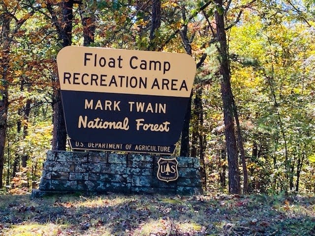
My family lives near the Mark Twain National Forest and I had my thoughts set on hiking at a river by this forest.
The forest was officially opened in the 1930s. It consists of 1.5 million acres in 29 counties in Missouri. Officially it’s supposed to cover 3 million square acres. There are over 750 miles of trails in the forest.
I decided to hike along the Current River with an access point located near Doniphan, Missouri. This particular place was called a “float camp” and it was located at an access point of the forest. It was called a float camp because it allowed access for small boats or rafts to enter.
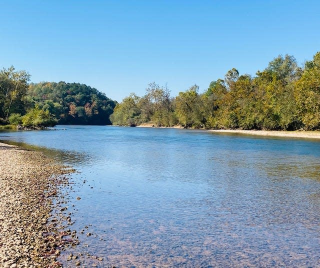
The Current River forms in the southeastern portion of the Ozark of Missouri. It is 184 miles in length and it eventually empties into the Black River in Arkansas.
Once called, the “Spring of the Summer Sky,” the river displays a vivid, deep blue color which is attributed to its depth and mineral content. The Current River is known to be the most spring-fed river in the state, with hundreds of fresh springs and caves.
It is a part of the Ozark National Scenic Riverways.
The river is also known for it’s towering dolomite bluffs, caves, underground springs, crystal clear water, deep pools, and swift currents.It’s also great for trout fishing. You might find a few black bears around.And it’s a river with many historic sites.
It was a perfect day to hike when I got out to this river: blue skies and 70 degrees. The leaves in the trees were stubbornly holding onto their fall colors and the sunlight reflected off the surface of the nearby river caused a sparkling effect.
I made my way to a small parking lot and quickly found a small trail that led to the water's edge.
I chose to walk down the rocky shoreline of the river to look for rocks and enjoy the views along the way. So, follow the river is what I did.
What a wonderful walk it was. The water clear blue, the sun shining, and some very cool rocks along my path to explore. I was able to walk about a half of a mile before I had to turn around. These Ozarks were growing on me for sure.
It was a very pleasant afternoon at the river. Afterward, I explored a bit of the campgrounds and one of the nearby forest trails.
The trees I had seen in southern Missouri were not as tall as what we are used to at home. But what they lacked in height, they made up for in fullness. Everything was the color of fall.
It had been another day of adventure in Missouri! It was a great hike!
To get to this place: The access for this section of the Current River is located in a section of the Mark Twain National Forest and the address is Forest Rd 3210, Doniphan, Missouri.
A quote for your week: “A river has great wisdom and whispers its secrets to the hearts of men.” — Mark Twain, American writer, humorist, lecturer, publisher, 1835-1910
Until the next trail,Susan
This article originally appeared on The Herald-Times: Hiking alongside the Current River in Mark Twain National Forest
