Former RI governor's estate Canonchet Farm is a great nature classroom for a family hike
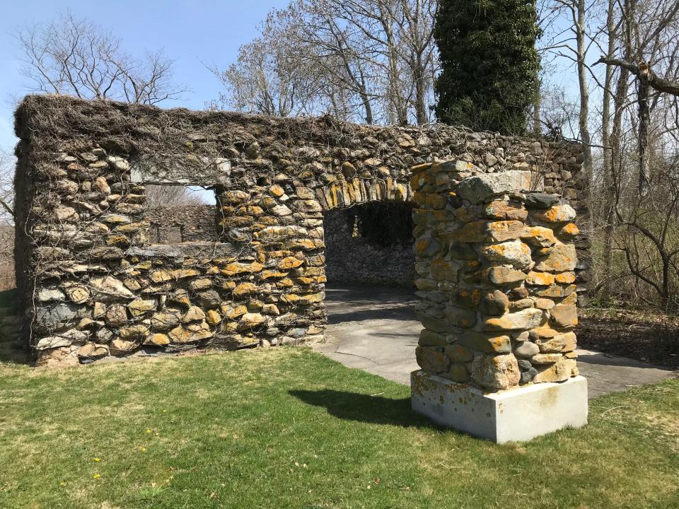
NARRAGANSETT — On a hillside overlooking Pettaquamscutt Cove, the shell of a two-story stable with stone walls stands as one of the last vestiges of the once-sprawling estate of Gov. William Sprague.
Sprague and his wife, Kate Chase Sprague, purchased the land on the shores of the cove in the 1860s and created Canonchet Farm, named for the sachem of the Narragansetts — the tribe that had summered there for thousands of years.
The Spragues built a 64-room mansion on the high ground, but a fire destroyed it in 1909. After the former governor died, relatives farmed the land before selling some lots for houses. When new owners planned to build a development on the property, the Town of Narragansett bought 174 acres in 1973 and later partnered with the Friends of Canonchet Farm, a nonprofit group, to create a public preserve.
Over the years, volunteers have enhanced a pleasant, easy-to-walk trail that winds through second-growth forests, pastureland and wetlands, with views of the Narrow River.
Walking RI: Rediscover Hopkinton's beautiful Blue Pond from three lesser-known trails
Sights to see: Vernal pools, marshes, farm animals and ospreys
The 1.3-mile path is perfect for parents and grandparents to explain to youngsters the land’s rich history and point out vernal pools, chestnut trees, and freshwater and saltwater marshes. There are also farm animals to see and, if you’re lucky, an osprey soaring over the meadows.
I set out to explore the public sanctuary from the Narragansett Community Center and walked northeast on a wide path marked with orange diamonds that had been cleared of thick, green bull briar vines. White birdhouses hung from the trees.
Not far from the start, a short nature loop trail opens on the left, where teachers from a nearby grammar school sometimes give science lessons. To the west, some raised ground is visible that once supported the tracks of a streetcar line that connected East Greenwich to Narragansett, Wakefield and Peace Dale. It opened in 1899 and closed in 1922.
More: These 10 Rhode Island trails should be on your bucket list
Walking RI: Searching for clues about RI's early settlers on a walking tour of 5 Exeter cemeteries

The path then crosses several wooden bog bridges over wetlands and shallow streams covered with bright green skunk cabbage. A sign explains the importance of vernal pools, where wood frogs, spotted salamanders and fairy shrimp come to life every spring.
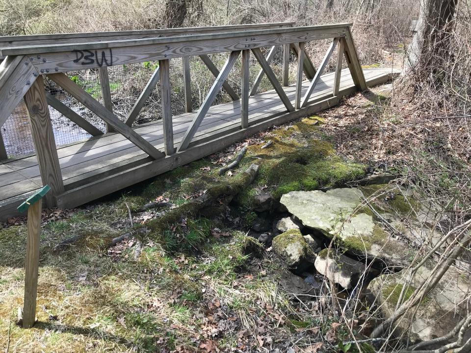
Farther ahead, the path crosses a sturdy, wooden bridge. If you look below, you can see a stone slab bridge built to carry heavy farm wagons over Crooked Brook, which flows across the property and empties into Pettaquamscutt Cove.
Walkers also pass chestnut trees, swamp white oaks and black oaks along the path that runs by two stone walls.
Working farm is part of the South County Museum
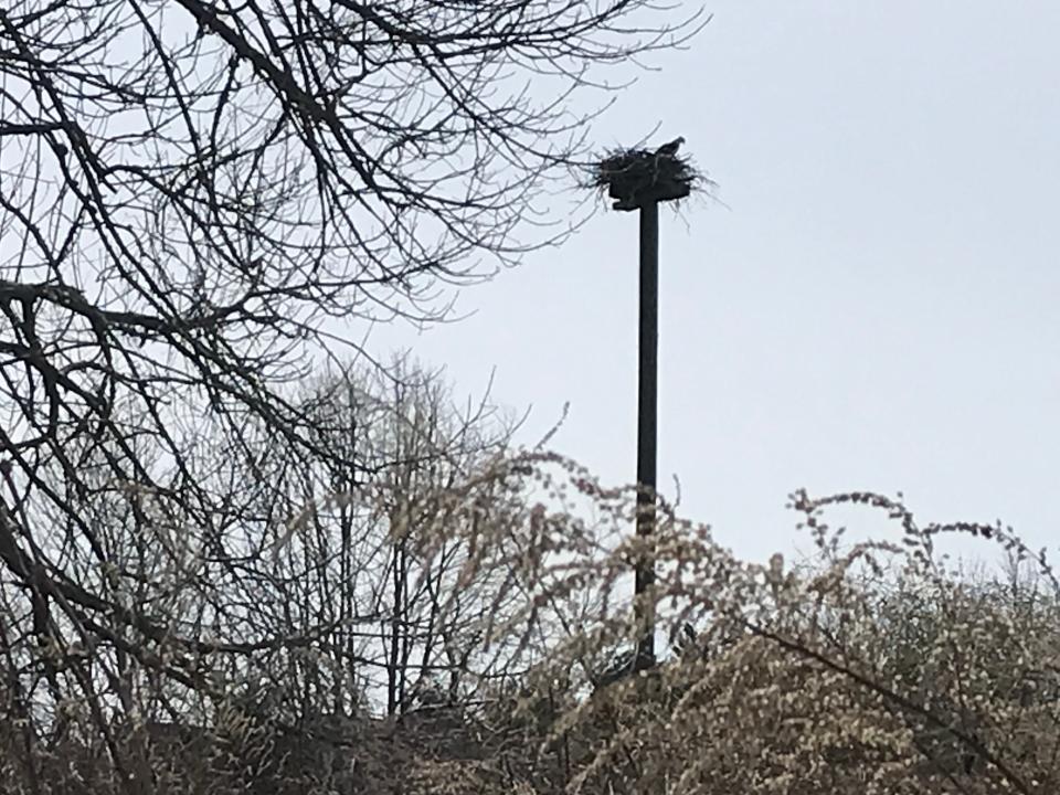
Rising on a gentle incline, the trail cuts behind sheds and a barn, where chickens clucked and sheep grazed. The working farm is part of the South County Museum. The town owns the land there and leases it to the museum. Just uphill to the right is a tall pole with an osprey nest. One of the fish hawks flew away as I approached.
The trail breaks to the left and crosses an area in front of a stone wall where volunteers have cleared out invasive plants such as privet, multiflora rose, bittersweet and barberry. They also have planted a dozen red oak, hophornbeam and trident maple saplings to keep out the non-native invasive plants.
When volunteers were clearing the walls, they found an old well that may have been part of the Spragues' summer mansion. The house is gone now, as is a water system that 19th-century maps show included a windmill and tank probably built to water the livestock.
Walking RI: This Hopkinton RI trail was featured in Wes Anderson's 'Moonrise Kingdom'
Walking RI: Up for a challenge? Tippecansett South Trail is a rigorous, rewarding workout
The path then runs northeast and is lined with a stone wall on the right and a low retaining wall on the left that holds the ground in place above lowlands that spread toward the west.
As the trail bends north, there are views of lines of stone walls that probably served to corral the livestock that grazed in the pastures. Second-growth forests now cover the land.
A side trail opens on the left and forms a loop that runs to the edge of the salt marsh at the southern edge of the Pettaquamscutt (Narrow) River, also known as Pettaquamscutt Cove. The wide openings in the stone walls gave wagons access to salt marsh hay that was cut to feed cattle.
Nearby attraction: John H. Chafee National Wildlife Refuge
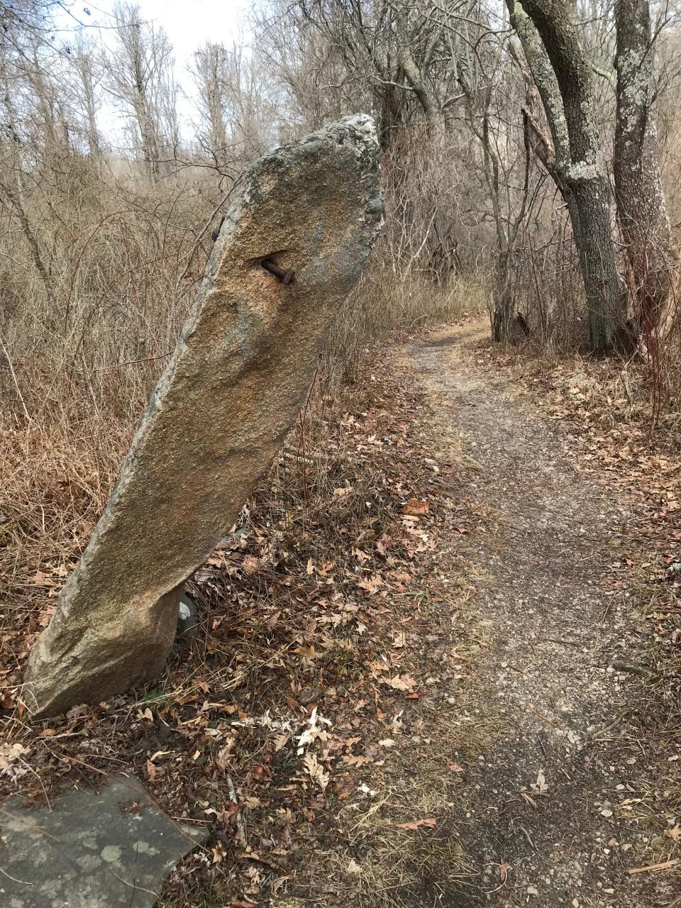
The trail then passes the John H. Chafee National Wildlife Refuge on the left and runs through a sassafras grove before turning south by a tilted granite post with an iron ring that may have been a hitching post or a gate. Another post lies on the ground.
There’s a stand of gray and white birch trees on the left and paths that open through a stone wall and run to Littleneck Pond.
The Spragues once ran a quarry in the area, and the granite stones may have been used for walls, roads and signposts on the property. A few rough-cut blocks are still visible.
The trail meanders past a stand of Norway spruce trees and a huge split erratic, a boulder left from the Ice Age. After passing some large beech trees, the path reaches a parking lot and Anne Hoxie Lane, which leads to Route 1A. Lake Canonchet is to the south, and Narragansett Town Beach is visible to the east.
Walking RI: 5 great hikes with ocean views
Walking RI: See rugged coastline and 100-year-old ruins at Narragansett's Black Point
I took a path west through a field and after a short distance reached the yellow-painted South County Museum. Across from the museum are the ruins of the two-story stable, which has windows, an arched entrance, a stone floor and a fireplace. The roof is gone.
Former Governor Sprague built the round stone and granite stable in 1900. The bottom level included space for 12 horses, two box stalls and a carriage room. The second story had quarters for footmen, coachmen and grooms, as well as a harness and tack room and storage for hay and grain.
After Sprague died in 1915, horse breeders and a riding school used the stables before they burned in 1968.
Walking RI: Stroll through industrial history in Slatersville, America's first planned mill village
What is the geological feature known as a 'roche moutonnee'?
From the stables, I walked along a road by several buildings and a unique granite outcropping called a roche moutonnee, which means “rock sheep,” because the sloping surface resembles a sheep with its back to the wind.
Just down the road is the walled Robinson Burial Ground. The Robinson family farmed the surrounding land that was acquired by Colonial settlers as part of the Pettaquamscutt Purchase (1658-1659) from the Indigenous people who lived there.
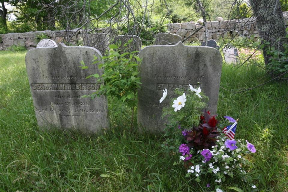
William Robinson (1694-1751), deputy governor of the Colony of Rhode Island and Providence Plantations, owned more than 3,000 acres in the Point Judith area, including Canonchet Farm.
The remains of many prominent members of the Robinson family were moved to the Riverside Cemetery in Wakefield in the late 1800s.
After exploring the graveyard, I walked along a fence by the osprey nest to the trail I had started out on and returned to where I'd begun after walking for 90 minutes.
The Friends of Canonchet Farm have more plans for the property, including creating paths and a park around the ponds on the east side of the land.
The enhancements will make an already interesting public preserve only better.
If you go ...
Access: Off Route 1A, take Mumford Road to the trailhead next to the Narragansett Community Center.
Parking: Available at a paved lot.
Dogs: Allowed but must be leashed.
Difficulty: Easy, on wide, flat paths.
Trail Tip
John Kostrzewa will discuss Walking Rhode Island, his hiking column, on May 6 at 10 a.m. at the South County Museum, 115 Strathmore St., Narragansett, followed by a guided walk on the trails through Canonchet Farm.
Register at canonchet.org.
The Walking Rhode Island column runs every other Sunday. John Kostrzewa, a former assistant managing editor/business at The Providence Journal, welcomes email at johnekostrzewa@gmail.com.
This article originally appeared on The Providence Journal: Historic Canonchet Farm in Narragansett is perfect for a family hike

