Wintry mix possible overnight; Cold to start week
QUICK-LOOK FORECAST:
Wintry mix possible overnight
Some flurries/light snow showers; especially north
Cold to start the week
>> TRACK THE CONDITIONS WITH LIVE DOPPLER 7
DETAILED FORECAST:

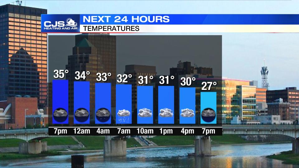
OVERNIGHT: Some light wintry mix/snow showers overnight.
Storm Center 7 Meteorologist Robert Gauthreaux says roads were warm Sunday, so travel impacts should be minimal across most regions.
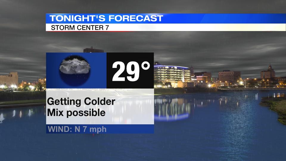
Best chance for light snow will be in counties to the north and northwest. Lows in the upper 20s.
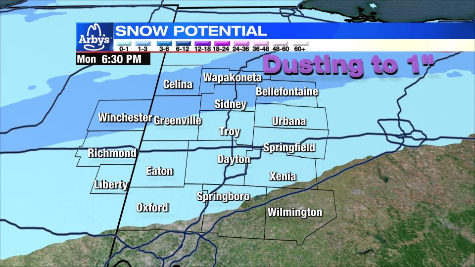
MONDAY: Better chance for some light snow accumulation to the north and northwest during the morning hours.
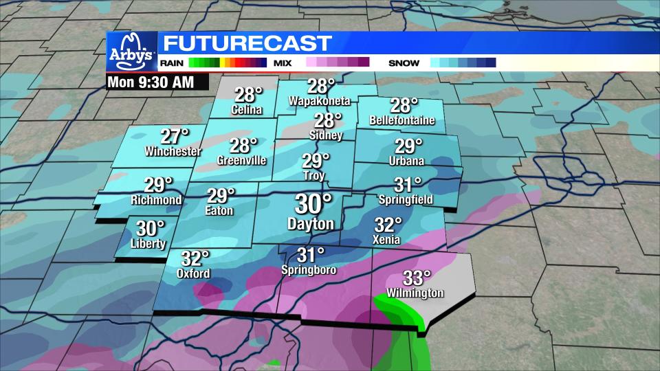
Overall, light dusting possible, to possibly an inch in northern counties.
Otherwise mostly cloudy with highs in the low 30s.
TUESDAY: The coldest day of the week! We start out in the teens and only make it to the upper 20s for highs. A few clouds.
WEDNESDAY: Another cold day. Starting in the mid teens and highs barely reach 32 degrees. Partly cloudy and dry conditions expected.
THURSDAY: Cold morning gives way to a less cold afternoon. Highs in the upper 30s with partly sunny skies.
FRIDAY: Cold again with highs only in the low 30s. Mostly sunny.
SATURDAY: Partly sunny and milder with highs in the upper 30s.
SUNDAY: Mostly sunny and mild with highs near 40.

