UK weather: snow and ice set to cause chaos for commuters
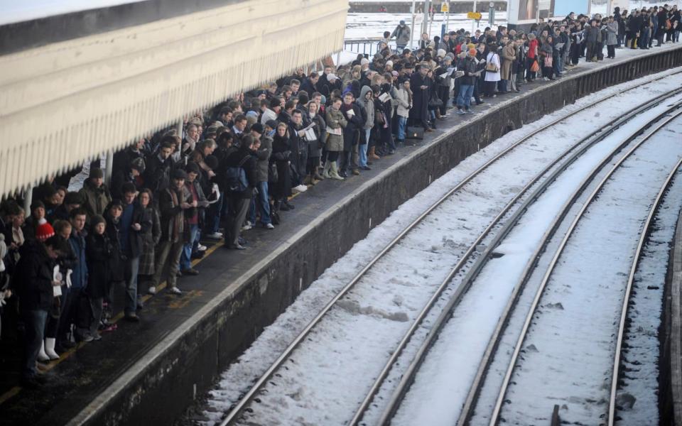
The worst snowfall in years will cause chaos for commuters on Monday and could cut off rural communities, forecasters have warned.
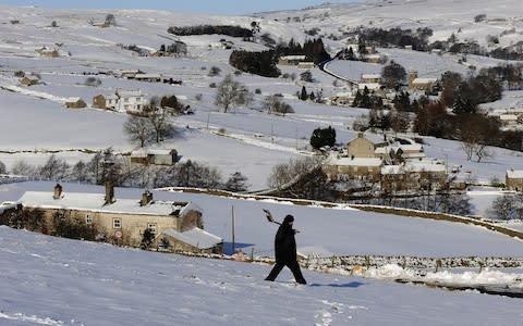
Almost a foot of powder is expected to be dumped across the country as temperatures plummet to -12 in the biggest whiteout since 2013.
Snow and ice may reach as far as Devon and Cornwall and stretch up to the far north of Scotland and temperatures will struggle to rise above freezing, forecasters say.
Approximately four inches of snow will fall within a three hour spell, known as a snow bomb, causing the most significant amount of chaos for years.
In preparation for the cold snap Highways England have warned motorists to pack a winter kit with blankets and warm clothes as hundreds of gritters are working 24 hours a day to keep the roads safe.
Rail firms are running overnight 'ghost trains' to clear snow and ice as Heathrow and Gatwick keep snowploughs and blowers on standby to tackle snow flurries.

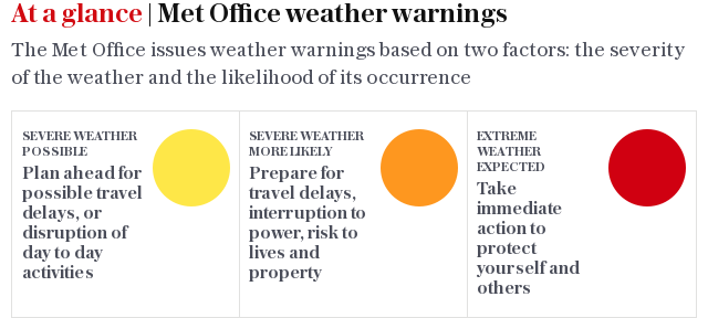
The Met Office have issued amber weather warnings of heavy snow for north Wales and north-west England whilst parts of Yorkshire and the Humber, east of England and the home counties could also be affected.
The south coast will also be battered by 60mph gales and rain in the wake of Storm Caroline.
A spokesperson said: "Road, rail and air travel delays are likely as well as stranding of vehicles and public transport cancellations.
"There is a good chance that some rural communities could be cut off.
"This has the potential to cause quite widespread disruption to transport, power outages and isolation for some rural areas, it will not be a pleasant day.
Roughly 10cm of snow is expected to widely fall across the country but over 20cm may fall in the worst hit areas such as north west England and Scotland.
Forecaster Mark Wilson said: "There is a chance that we will have very challenging driving conditions for parts of the UK on Monday morning, there is a risk of quite a lot of ice and it will feel bitterly bitterly cold.
"There is a risk of black ice across central and northern parts of the UK, anywhere that has had snowfall on Sunday will see it freeze overnight making travel challenging on Monday morning.
"For parts of the UK such as the midlands and further north this will be the most significant snow event since 2013.
"This is the coldest start to December we have had since 2013 and overnight temperatures will be up to -12, an extreme low across the whole of the UK.
"The last time an amber snow warning was issued was in March 2013."

